Exuma Cays Land & Sea Park history: who founded it, the 1958 expedition and no-take
Exuma Cays Land & Sea Park began in 1958 with an expedition assembled by Ilya Tolstoy. Who founded it, the Trust Act, the 176-square-mile park and no-take.
The Exuma Cays Land & Sea Park traces to a January 1958 survey led by Carleton Ray, with Ilia Tolstoy as the driving force, which recommended a 176-square-mile park run by a new Bahamas National Trust1,2. The Trust Act was signed on 13 July 1959, and the park was then officially established as the first of its kind in the world1.
- At a glance
- Idea first raised
- 1953, by Ilia Tolstoy2
- Cays set aside
- 13 Feb 1956, for one year2
- Survey
- 19 to 28 January 1958; report May 19582
- Trust Act signed
- 13 July 19591
- Proposed size
- 176 square miles, 8 by 22 miles2
- Size today
- 112,640 acres1
On this page
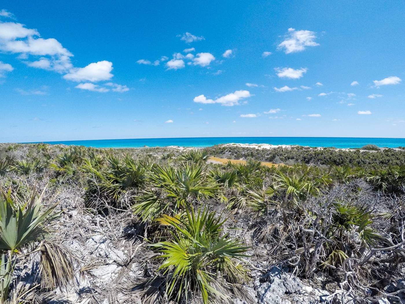
The park began as a conversation about a few islands, became a survey and turned into a Trust and a park. This page follows that history in order, including the places where the dates do not line up. For today’s rules and fees, go to the park hub.
When was Exuma Cays Land & Sea Park established?
The Bahamas National Trust dates the park to 1958 and calls it the first marine reserve in The Bahamas and the wider Caribbean1. The year it names is the year of the survey, though. The Trust’s own history says the 176-square-mile park was officially established after the government adopted the survey team’s recommendations, and that came with the Trust itself, created by the Act signed on 13 July 19591.
So both years are right in their own way: 1958 for the expedition and the proposal, 1959 for the legal structure. The Trust calls the park the first of its kind in the world1, and The Nature Conservancy calls it the first no-take zone in the Caribbean8.
How did the idea start?
Ilia Tolstoy, grandson of the Russian author Leo Tolstoy, did not set out to create the Bahamas National Trust1. He was a naturalist who saw that the Exuma chain was under threat from developers who wanted to buy it1. His own account, printed in the 1958 survey report, starts in 1953: “I started to talk to different people about the advisability and possibility of setting aside some islands in the Bahamas”2.
He took the idea to the Governor and the Colonial Secretary in the spring of 19552. On 13 February 1956 the Governor wrote to confirm that the Crown had set aside the Exuma Cays from Shroud Cay to Little Bell Island, for one year2. The deal came with a condition: some organization had to explore the idea and pay for it2. A one-year extension followed, to 30 June 1958, and the Governor visited the cays in September 19572.
Who made the 1958 survey?
The survey ran under the New York Zoological Society and the Conservation Foundation, and the report is dated May 19582. Its cover gives the survey dates as 19 to 28 January 1958, with shore trips to Shroud Cay on 23 January, Cistern Cay on 25 January and Warderick Wells on 26 January2.
Ten people made up the expedition2. Carleton Ray of the New York Aquarium led it, and the Trust says Ray and the other members were responsible for creating the park5. The Trust also names Bahamian officials Oris Russell and Herbert McKinney, Robert P. Allen of the National Audubon Society, and Dan Beard, John Randall and Don Squires1. Their report concluded that the area had “outstanding natural values”1.
Ray lived from 15 August 1928 to 14 December 2023, and the Trust calls him the last living founding member of the Bahamas National Trust5.
What did the 1958 report recommend?
The report asked for a national park run by a proposed Bahamian National Trust in cooperation with the government2. Several of its proposals are recognizable in the park today.
- Size and shape: a park 8 miles wide and 22 miles long, 176 square miles in all, with only 8.75 square miles of land, about 5%2. The boundary would reach up to 3 miles seaward on the east and 5 miles on the west2.
- Sea included: the report held the inclusion of marine areas in the park mandatory2.
- Pause on development: an immediate moratorium on leasing or other development in the park area2.
- A larger option: adding Norman’s Cay would have raised the total to 216 square miles2.
- A ranger: at least one ranger, who would report violations and keep a visitor log, with the Trust paying the salary2. The Trust itself would not be an enforcement or regulatory agency2.
- Penalties: confiscation of the boat as the heaviest penalty for hunting or fishing in the park2.
From fishing limits to no-take
The 1958 report did not ask for a full no-take zone. It proposed closing the marine areas to all types of fishing except trolling in deeper water, over 10 fathoms2. It made possession of spear-guns an offense, and it would have let residents of the park area fish for their own use but not spear-fish or hunt2. The land would be closed to hunting and to cutting foliage2.
The Nature Conservancy says the park’s waters have been managed as a no-take reserve since 1986, and that it began working with the Trust on the park in 20008. The rule today is stricter than the 1958 proposal: no fishing, conching, shelling or lobstering, and nothing living or dead may be removed from within the park’s boundaries4. The penalty for poaching is fines and confiscation of vessels4. The no-take zone guide covers what the rule means on the water.
Timeline
| Year | What happened |
|---|---|
| 1953 | Tolstoy begins talking to conservationists about setting aside Bahamian islands2 |
| 1955 | Tolstoy presents the idea to the Governor and Colonial Secretary2 |
| 13 Feb 1956 | Crown sets aside the cays from Shroud Cay to Little Bell Island for one year2 |
| Sept 1957 | Governor visits the cays; time limit extended to 30 June 19582 |
| 19 to 28 Jan 1958 | Survey of the Exuma Cays2 |
| May 1958 | Survey report submitted to the Bahamian government2 |
| 13 July 1959 | Bahamas National Trust Act signed1 |
| 2018 | Platinum Global Ocean Refuge Award1 |
Who was Peggy Hall, the early park warden?
The Tribune’s tribute to Peggy Hall says the park came under pressure from development on land and poaching by sea as people discovered the beauty and accessibility of the islands6. As the park fell victim to lack of oversight, the Trust called on its lifetime member Peggy Hall6.
She took over as park warden and declared the park the first “No Take” preserve in the Bahamas6. She lived aboard her boat Moby, with her dog Powerful, during her years in the park6. The park also became the focus for volunteer helpers, including the youth groups of Raleigh International6.
What has the park become?
The park is the most visited national park in The Bahamas1. In 2018 it won the Platinum Global Ocean Refuge Award1. The Bahamas Defence Force has stationed three officers at Park Headquarters to assist park staff with enforcement matters1. The park office is on a remote small island, so the Trust warns that contacting it can sometimes be challenging1.
Headquarters sits on Warderick Wells, where a cruiser’s custom is to leave a driftwood sign with the boat’s name at the top of Boo Boo Hill3. A small population of Bahama hutia was transplanted to two locations, Little Wax Cay and Warderick Wells7. Read about the base in Warderick Wells headquarters.
For the basics of what you are visiting, see what the park is. For where the boundary falls, see the boundaries and map page. To help the Trust that came out of the survey, read how to support the park. Read the park rules before you arrive.
Read next
What is the Exuma Cays Land & Sea Park? Size, rules and who runs it
The Exuma Cays Land & Sea Park explained: when it was founded, how big it is, who runs it, what it protects and what boaters and day-trippers need to know.
parkExuma Park no-take zone: what it bans, why it exists and how to report poaching
Fishing, conching, shelling and lobstering are banned in Exuma Cays Land & Sea Park. What the no-take rule covers, the penalties, and how to report poaching.
parkExuma Cays Land & Sea Park boundaries: corner coordinates and area
The four corner coordinates of the Exuma Cays Land & Sea Park from the Bahamas National Trust, the park's size, and which cays fall inside the boundary.
Questions people ask
When was the Exuma Cays Land and Sea Park established?
The Bahamas National Trust dates the park to 1958, the year of the survey that proposed it1. The 176-square-mile park was officially established after the government adopted the survey team's recommendations and the Trust Act was signed on 13 July 19591.
Who founded the Exuma Cays Land and Sea Park?
Ilia Tolstoy began promoting the idea in 1953 and assembled the 1958 survey group of Bahamian and North American conservationists1,2. Carleton Ray led the expedition and edited its report2,5. The government then adopted the team's recommendations1.
Is the Exuma Cays Land and Sea Park the first marine reserve?
The Bahamas National Trust calls it the first marine reserve in The Bahamas and the wider Caribbean, and the first of its kind in the world1. The Nature Conservancy calls it the first no-take zone in the Caribbean8.
Sources (8)
- Exuma Cays Land & Sea ParkBNT
Bahamas National Trust · bnt.bs · checked 2026-10-18 - Exuma Cays Park: survey reportGOV
US National Park Service · npshistory.com · checked 2026-10-25 - Exuma Cays Land and Sea Park
Wikipedia · en.wikipedia.org · checked 2026-10-18 - Exuma Cays Land and Sea Park Rules (PDF)BNT
Bahamas National Trust · bnt.bs · checked 2026-10-18 - In Memoriam: G. Carlton Ray, Founding Member of The Bahamas National TrustBNT
Bahamas National Trust · bnt.bs · checked 2026-10-19 - Tributes to Peggy Hall
The Tribune (Nassau) · tribune242.com · checked 2026-10-19 - Exuma Cays Land and Sea Park (The Nature Conservancy)
The Nature Conservancy · nature.org · checked 2026-10-25 - Bahama hutia (BNT fact sheet)BNT
Bahamas National Trust · bnt.bs · checked 2026-10-18
Photo credits (2)


Park fees and rules come from the Bahamas National Trust or the Bahamas government; check them again before you go. How we check facts.